Logo

  • Home
  • For First-time Visitors
    • About the Network
      • Who We Are
      • How It Works
      • What We Do
      • Why We Exist
      • History
      • Contacts
    • Getting Started
    • Network Grants
  • For Program Staff
    • Benefits
    • Find a Data Exchange
    • Network Grants
    • Data Exchange Status
    • Learn about Project Teams
  • For IT Staff
    • Getting Started Guide for IT Professionals
    • Download Node Software
    • Find Existing Data Exchanges
    • Knowledge Base and Technical Standards
    • Exchange Network Discovery Service
    • Learn about Project Teams
    • Learn about Available Shared Services

Sharing information for a cleaner environment

  • About
    • Who We Are
    • How It Works
    • What We Do
    • Why We Exist
    • Network Grants
    • Governance
    • Tribal EN Group (TXG)
    • Contacts
      • Exchange Network Help Desk
  • Data Exchanges
    • Air
    • Cross-Program
    • Health
    • Natural Resources
    • Waste
    • Water
  • Meetings
  • Partners
  • Knowledge Base
  • EN Alerts
  • Air
  • Cross-Program
  • Health
  • Natural Resources
  • Waste
  • Water
    • Ambient Water Quality
    • Drinking Water Quality
    • Geospatial Information
    • Point Source Monitoring
Home › Data Exchanges › Water › Geospatial Information

Geospatial Information

SupportSupport

Profiles and Progress

Click the map to find contact information for Exchange Network Partners and to see Partners' progress toward implementing data exchanges on the Network.
Exchange Network Map

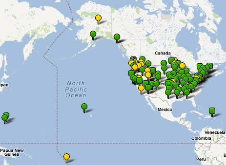
Geospatial Information belongs to Water

National Hydrography Dataset Events – NHDEvent

The National Hydrography Dataset Events (NHDEvent) data exchange has been decommissioned as of September 2020. These resources are only available for reference purposes. Please do not attempt to implement this data exchange. The National Hydrography Dataset Events (NHDEvent) data exchange enables participants to submit spatial representations of surface water-related features. It supplements water program-related data flows that exchange surface … View Data Exchange »

National Hydrography Dataset Update – NHDUpdate

The National Hydrography Dataset Update (NHDUpdate) data exchange enables the transmittal of updates to the National Hydrography Dataset (NHD) created by local updaters or state NHD data stewards to the national NHD data repository administered by the United States Geological Survey (USGS). The flow also enables USGS to send updates from the national repository to satellite NHD databases … View Data Exchange »

  • Home
  • About
  • Site Map
  • EN Alerts
  • Contacts

© 2023 E-Enterprise and Exchange Network Interoperability and Operations Team

Powered by Swapps