Logo

  • Home
  • For First-time Visitors
    • About the Network
      • Who We Are
      • How It Works
      • What We Do
      • Why We Exist
      • History
      • Contacts
    • Getting Started
    • Network Grants
  • For Program Staff
    • Benefits
    • Find a Data Exchange
    • Network Grants
    • Data Exchange Status
    • Learn about Project Teams
  • For IT Staff
    • Getting Started Guide for IT Professionals
    • Download Node Software
    • Find Existing Data Exchanges
    • Knowledge Base and Technical Standards
    • Exchange Network Discovery Service
    • Learn about Project Teams
    • Learn about Available Shared Services

Sharing information for a cleaner environment

  • About
    • Who We Are
    • How It Works
    • What We Do
    • Why We Exist
    • Network Grants
    • Governance
    • Tribal EN Group (TXG)
    • Contacts
      • Exchange Network Help Desk
  • Data Exchanges
    • Air
    • Cross-Program
    • Health
    • Natural Resources
    • Waste
    • Water
  • Meetings
  • Partners
  • Knowledge Base
  • EN Alerts
  • Air
  • Cross-Program
  • Health
  • Natural Resources
  • Waste
  • Water
    • Ambient Water Quality
    • Drinking Water Quality
    • Geospatial Information
    • Point Source Monitoring
Home › Data Exchange › Cross-Program › Geospatial Data Exchanges

Geospatial Data Exchanges

SupportSupport

Data Exchange Description

Exchange Network partners have identified various issues associated with the use and exchange of geospatial data on the Exchange Network. In late 2006, the Exchange Network Leadership Council (ENLC) convened an Exchange Network Geospatial Strategy Team to examine the following issues:

  • What are the best options for encoding geospatial data for exchanges on the Exchange Network?
  • What are the challenges and options associated with multiple coordinate reference systems used by EPA, States, tribes, and others to represent geospatial data of interest in exchanges on the Exchange Network?

The team issued its report to the ENLC in July of 2007 and recommended adopting Geography Markup Language (GML) as the standard for sharing geospatial data over the Exchange Network. Furthermore, the team recommended exploring the use of GeoRSS GML (a specific sub-set of GML) where expression of simple geospatial data in Exchange Network flows is required.

Geospatial Task Force

An Exchange Network Geospatial Task Force came together in 2008 to explore the recommendations contained in the Strategy Team’s Report in an effort to provide further clarity and explicit guidance to Exchange Network Partners seeking to exchange geospatial data. The Task Force developed Analysis of Integrating Geospatial Data into Exchange Network Schema and later published Recommended Practices for Integrating Geospatial Data into Exchange Network Schema. Partners building data exchanges with a geospatial component should consult these resources.

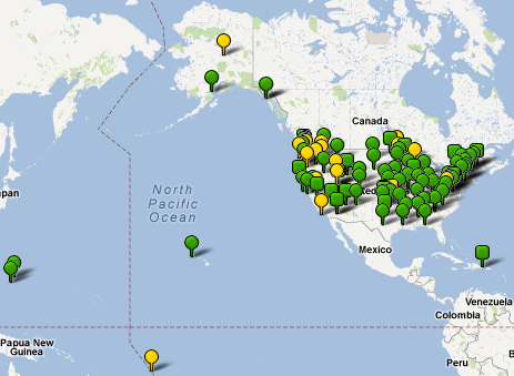
Profiles and Progress

Click the map to find contact information for Exchange Network Partners and to see Partners' progress toward implementing data exchanges on the Network.
Exchange Network Map
  • Home
  • About
  • Site Map
  • EN Alerts
  • Contacts

© 2023 E-Enterprise and Exchange Network Interoperability and Operations Team

Powered by Swapps