Data Exchange Description
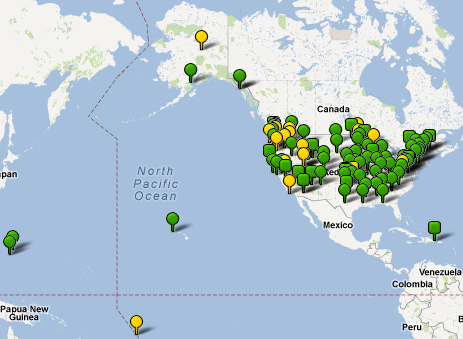
The National Hydrography Dataset Update (NHDUpdate) data exchange enables the transmittal of updates to the National Hydrography Dataset (NHD) created by local updaters or state NHD data stewards to the national NHD data repository administered by the United States Geological Survey (USGS). The flow also enables USGS to send updates from the national repository to satellite NHD databases administered by other agencies, including state stewards of the NHD.
This data flow was developed by the United States Geological Survey – NHD Team and the Land Management Information Center, Minnesota Department of Administration. Supporting agencies included the Minnesota Pollution Control Agency and the U.S. Environmental Protection Agency – Office of Water.
Background
The National Hydrography Dataset is the national geospatial framework theme layer for Hydrography. NHD is a comprehensive set of digital spatial data that contains information about surface water features such as lakes, ponds, streams, rivers, springs and wells. The NHD interconnects and uniquely identifies the stream segments or reaches that make up the nation’s surface water drainage system. The NHD is a framework for spatial position for surface water features, their attribution, their connectivity in a flow network, and an addressing system for linking additional related data known as events. Because the NHD provides a consistent framework for addressing and analysis, water-related information linked to reach addresses by one organization can be shared with other organizations and easily integrated into many different types of applications.
The NHD is structurally designed to be updated based on local knowledge. Those updates depend upon partnerships established with a wide variety of organizations that work with geospatial hydrographic data. USGS has created tools to support the update activity and works cooperatively with these organizations to accept updates and improvements to the NHD through its NHD Stewardship activity (http://nhd.usgs.gov/webcoop.html).
The Update Process
This project developed the procedures necessary to support the transmittal of updates to the NHD through the Exchange Network. Because the USGS NHD Team had already developed a robust stewardship activity, data update procedures and tools (NHDGeoEdit), using a standardized XML update format, were already in place. Table definition structures had already been defined, if not described in the standard schema format required to support an Exchange Network data flow. This project completed the process and developed the documentation and tools necessary to formally transmit this data set as an Exchange Network Data Flow.
To implement this project the USGS established its own Exchange Network node to distribute and accept the NHD Update Flow data. This data flow process gives NHD stewards a secure, Web-based data transfer mechanism.
This data flow defines only NHD updates passed between NHD data stewards and other local updaters and the USGS NHD Database. Other users of NHD data can continue to use the data directly via an online internet map service or download NHD data through an already established web-based data distribution interface (See http://nhd.usgs.gov/data.html). This data flow will not be used to support routine data distribution to NHD users.
Version Notes
Status: Supported
The NHDUpdate documentation package has been approved for use on the Exchange Network. The most recent version is version 1.1. Implementation resources for this most recent version follow.
Resources
- Flow Configuration Document
- XML Schema
- Data Exchange Template
- Sample XML Header Files
- Sample XML Instance File
- Sample RCL file (right click and save to download)

